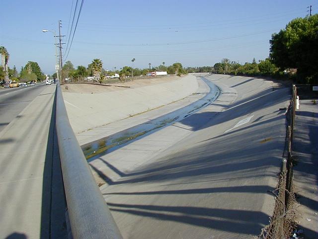
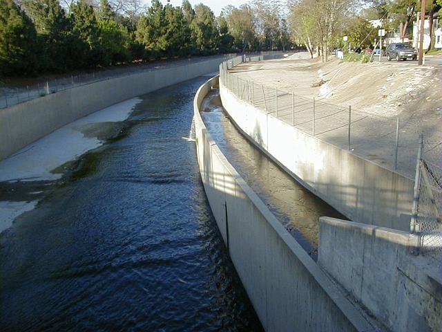
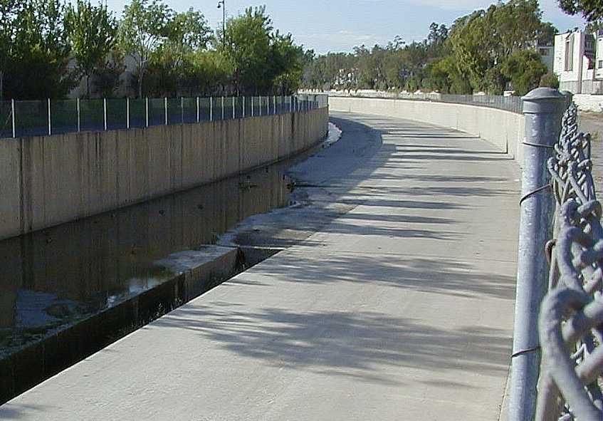
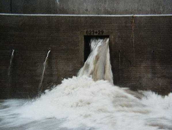
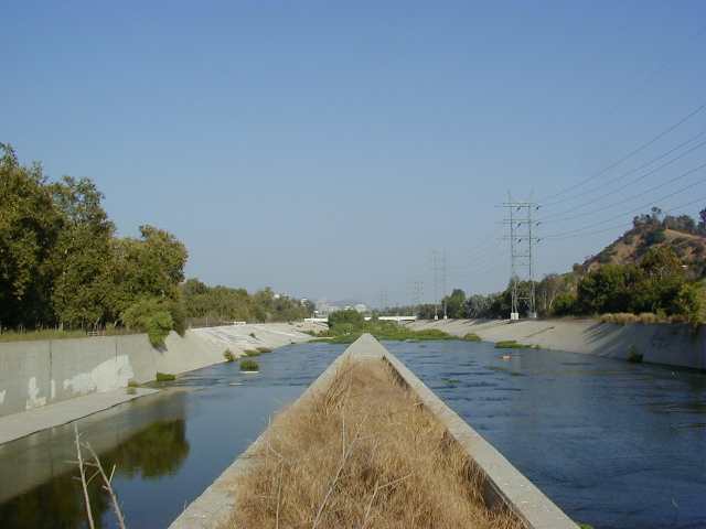
 1-19
1-19 LA River / Vanowen Overpass
 Looking south, downstream from the Browns Canyon Wash merging.
1-19
LA River / Vanowen Overpass
Looking south, downstream from the Browns Canyon Wash
merging.
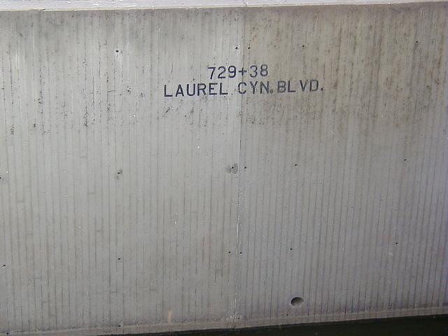
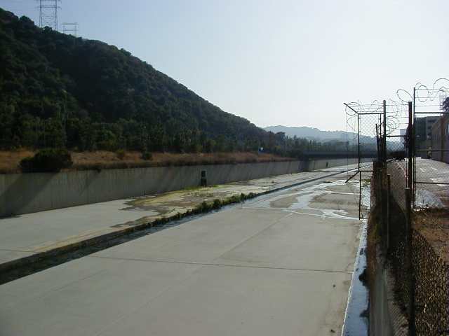
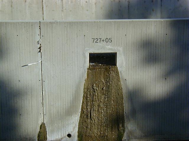 1-26
1-26
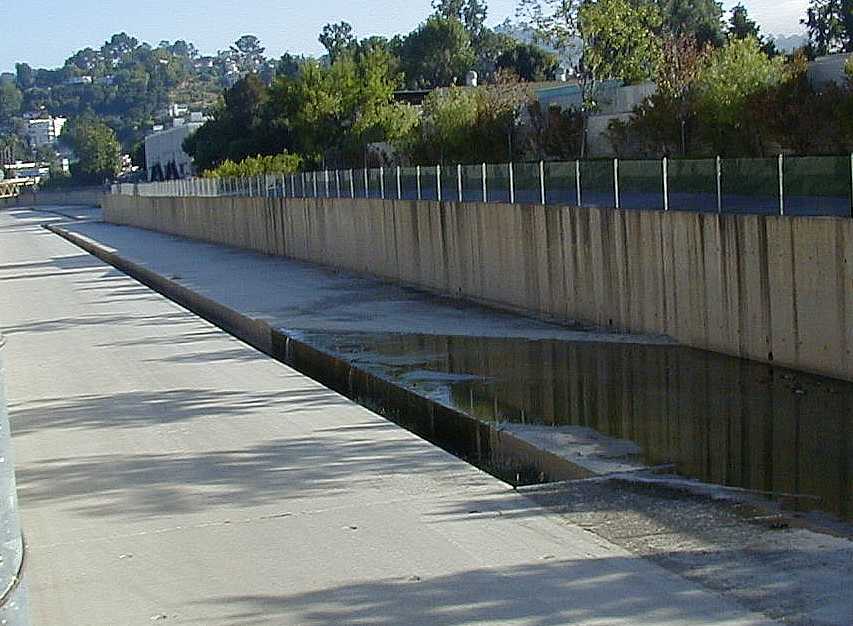
Storm Drain meets LA River
Laurel Canyon and Valleyheart Drive, Studio City.
Bleh. Someone should draw a face around it with the outlet as the mouth, so it looks like someone throwing up.
One of several such outlets that form the merging of this storm drain channel and the LAR. Most of the water from the drain is going through the outlet just 7 feet west (upstream), apparantly channeled there by some sediment in the storm drain's bed.
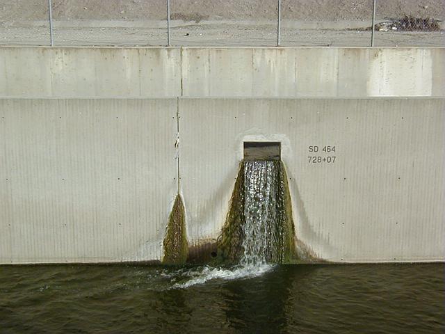 1-27
1-27
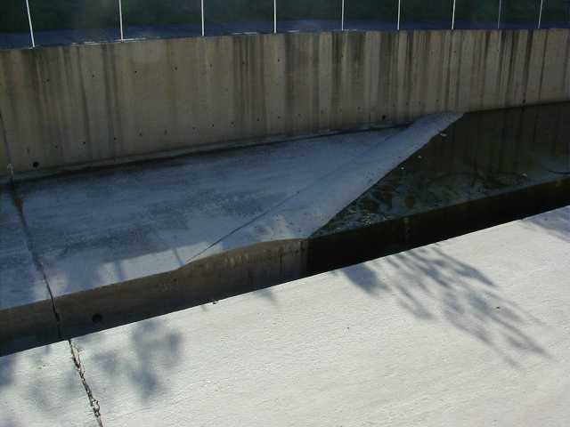
A more dynamic outlet just upstream from the above,
it looks like it's pushing a good 60 gallons per minute here.
Note water is also seeping through a crack in the wall,
as shown by the moss.
I'm assuming 'SD 464' is a 'Storm Drain' identifier.
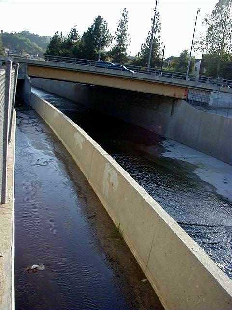 1-28
1-28
Storm drain side of the LAR. Note the drain runs some
distance in parallel with the river, before the 'box cut'
outlets empty it into the river. Not sure why.
 1-29
1-29
View from bridge showing storm drain channel, and
distant waterfall. Note river is not 'slotted' here,
but the bed does seem to be angled to cause low waters to hug
one bank, which seems to keep the flow moving quickly, preventing
stagnation the way the slot does. It's not consistent though; further
down river the bed is flat, where the water slows and stagnates.
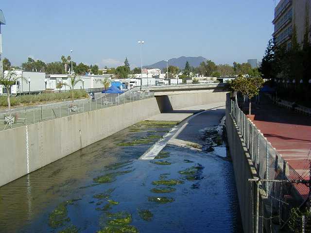
 1-30
1-30
LAR wall. Striation shows a different construction
technique was used here to form the walls.
To the right and left are the
CBS Radford Studios
(now known as CBS Studio Center), where Gunsmoke,
Gilligan's Island, Mary Tyler Moore, Rhoda, Phyllis, Lou Grant, and other
shows were shot.
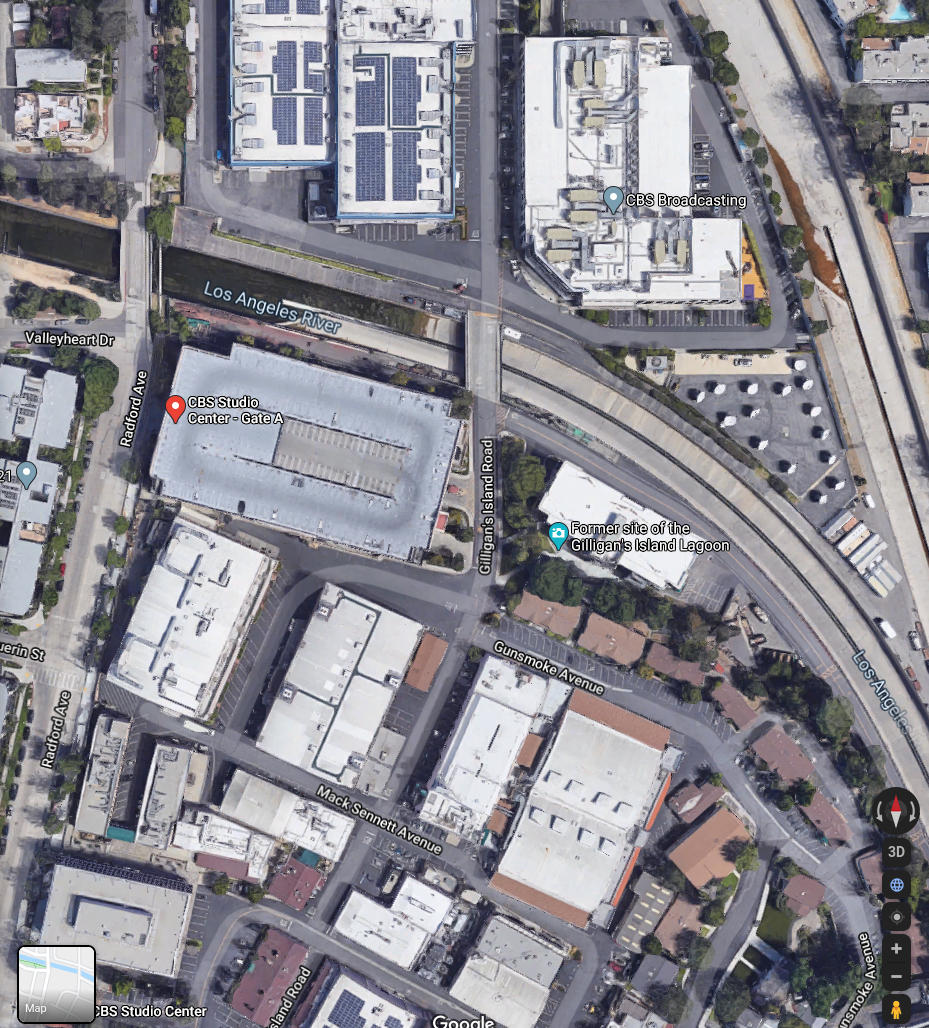
The set for Gilligan's lagoon (now a parking lot) was off to the right in the above photo, just around the curve in the river. There's even a street named "Gilligan's Lagoon Road" within the studio lot, shown in the following google map image:
Why the slot doesn't continue upstream I don't know.
During the long downstream run between the Sepulveda dam and the CBS studios,
the LAR has no slot at all. It is here that the slot begins again, and runs
uninterrupted for many miles until Griffith park, where the slot ends just
before the river transitions to dirt-bottom.
The slot certainly seems to be a good idea; it keeps the water contained
and moving quickly, so that it doesn't spread out, slow down, and grow algae.
When it does this, the water gets stagnant and stinky, bad for the residential
neighborhoods that run all along the river's edge.
Of note, before the slot begins, the river bed is graded here
so the low flow of water hugs the southern wall of the wash.
So the bump is only on the southern side of bed, to guide this
water to the slot, and allow vehicles to drive along the north
side of the bed. (While taking these shots, I counted about 8
maintenance vehicles zooming along the bed, a few minutes between
each, headed for points north, some at freeway speeds..!
The 'speed bump' nature of this wall (ie. it's rounded top)
is likely intended to allow maintenance vehicles to easily pass over it.
Note the bed becomes exactly twice as large, to accomodate
both rivers when full.
Wisely, an effort was made to join the slots too; no stagnation
or moss. It's amazing how devoid of junk and silt the riverbed is.
Here's an
overhead
picture of this section.
Like a small model of what the river must look like
when full, the merging slots show in scale the
dynamics of merging water.
Two large wakes are formed here, the first where the
fast running LAR water meets the slower TW water;
a wake forms as the water passes the 'point', where
it eddies as it hits the slower moving TR water.
A second wake forms where the fast running current
clears the point and reflects off the secondary wall,
and is forced diagonally back across the current.
A large 'waterfall' sound was coming from the merge,
indicating the water is definitely getting pissed off here.
Since this is a small scale, the engineers didn't need
to extend a merging wall for the slots, however one can
see how it would improve the large secondary 'reflection'
wake, which causes much turbulence across the entire width
of the slot's adjoinment.
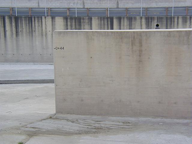
The negative distance marker ("-0+44") on the merging wall
(or "training wall") seems to imply the merging wall is not considered "part
of" the Tujunga Wash, but a possible retrofit (installed after the river was
constructed as an improvement), where the original "end" was 44 feet upstream
to the actual 0+00 mark.
I believe this is the case, because apparently
this photo,
dated 1948, shows Edward Koehn, Chief of flood control design for the LA district,
explaining "improvements" for this same section of the river, the Tujunga Wash confluence.
So possibly this "training wall" was added after construction of the river was completed,
perhaps explaining the negative numbers were an "add on" to the original project.
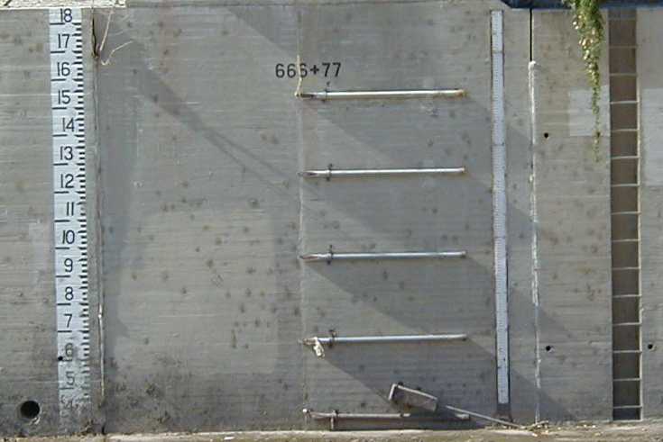
Of interest; the visual gauge starts at 3 feet at its base. Presumably
this includes the slot, and possibly a perpendicular grade across the
river. Most of the other visual gauges I've seen along the river
start at zero.
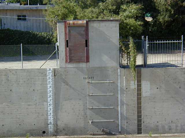
In the middle is what looks like a wide ladder, but these appear to be
fluted pipes (open end pointing upstream) that presumably sense the water
level and/or speed electronically, using equipment in the shack directly
above it to sense and transmit the data to the upstream Sepulveda flow
control dam.
To the extreme right is a maintenance ladder (a thin vertical channel
in the wall, with metal pipe steps). Likely this ladder is intended to allow
crews to clean the sensors, and inspect a
venturi meter
that that I assume can be positioned at the slot's constriction point.
Note the large perpendicular flow from the storm sewer causes
a large wake in the river. If the port were larger,
you can see how an enormous wake would form, impeding the LAR's downstream flow.
You can see the small channel in the bed along the wall, which
appears to keep the flow from such pipes hugging the wall,
preventing it from meandering across the bed and stagnating.
One thing that has always impressed and amazed me about the LAR
is how frigging clean it is. I mean, look at how /white/ it is.
As you can see in this shot, there's no dirt.. no sediment deposits
or stray rocks strewn about. And considering how brown with dirt
the waters are during flood conditions, it's amazing really that
dirt isn't strewn about in corners and along the flat surfaces
after each flood.
Are there little elves that clean it? Probably not.. I'm guessing
it's mostly due to the 'debris basins' in the mountains that catch
most dirt/rocks before they hit the concrete sections of the river.
But also there is maybe a 'self cleansing' action from the water
speed being so high, and as the flood waters subside, the dirty waters
become more clear, transporting most sediment to the ocean before
reverting to the usual low water condition that is seen normally.
Still, though, you'd think there'd be more random rocks and dirt
than there is.
Note the river banks transition from vertical to
slanted here, just where the two rivers meet.
Also note the serious greenery in the river bed
off in the distance; this is where the river
becomes dirt-bottom for several miles.
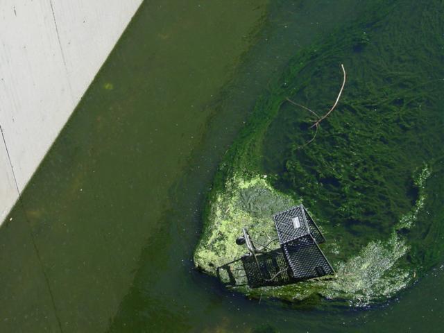 xx
xx
Shopping cart in ooze
This shot was taken by a loyal FOVICKS member.
Plant life abounds in this river.
 4-02-dead-tv
"Nothing's on TV tonight, honey."
Looks like someone decided to make a comment to the CBS programming director;
the studios are just a few hundred feet downstream from here ;)
Click here for a big hires
shot of this scene.
 4-13
4-13
Start of LAR slot, Radford overpass, CBS studios, Studio City.
We're approaching the confluence of the Tujunga Wash. This slot
in the LAR starts just before it.
 4-17
4-17
Tujunga Wash, looking downstream towards LAR confluence, Studio City.
We've jumped over to the Tujunga wash here, just 700 feet north of
where it intersects the LAR, where the Tujunga slot begins. You can
see the LAR intersection downstream.
 4-14
4-14
Flow control wall, Tujunga Wash.
This bump of concrete forces the water into the slot. The LAR
has this too, though it's harder to see because it has more water.
 4-15
4-15
Tujunga Wash, looking upstream from start of its slot, Studio City.
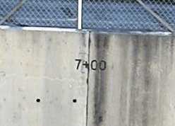 4-16-crop
Surveyor's mark above start of slot, Tujunga Wash.
According to this surveyor's mark on the wall of the Tujunga Wash,
we are exactly 700 feet upstream from where it terminates into the LAR.
I'm not sure exactly why, but the corps decided to be sure the slot starts
this far upstream from where it meets the LAR. The crack running
between the "7+" and the "00" extends down to the slot, the crack
defining the upstream wall of the slot; very precise.
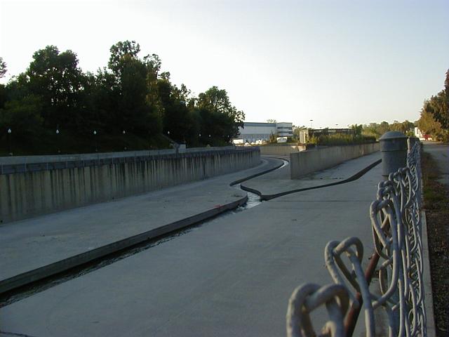
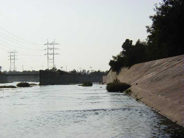
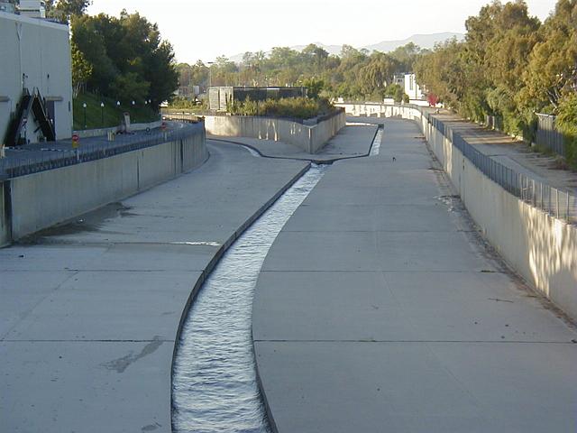 1-33
1-33
LA River (left) merges with Tujunga Wash (right).
The two rivers merge here at the CBS studios near Woodbridge
and Colfax in studio city.
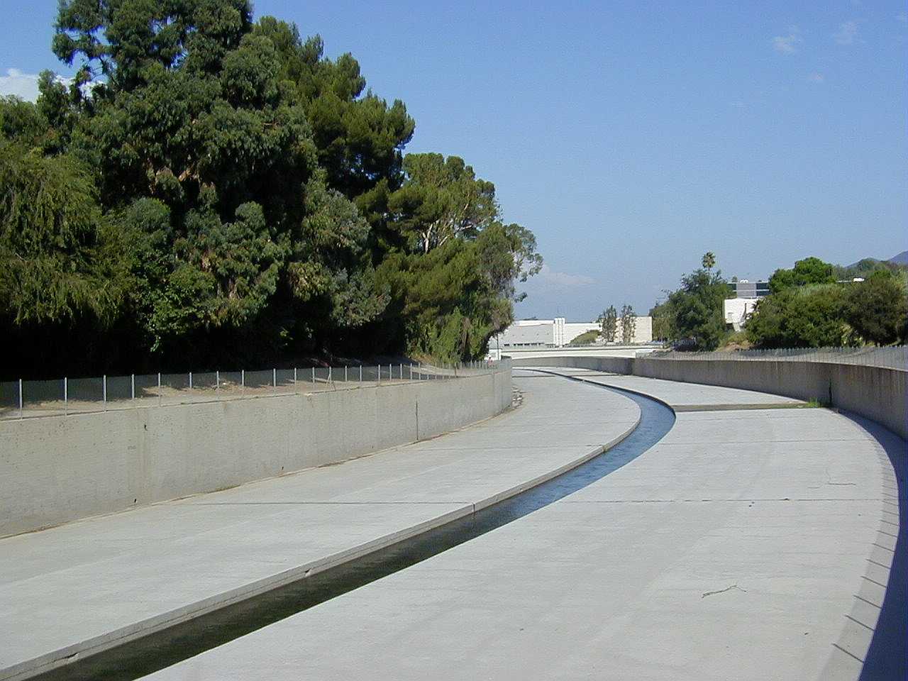
 1-34
1-34
Merging Slots
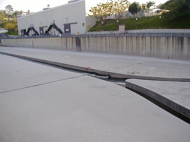
 1-36
1-36
Merging Wall, Tujunga Side
 1-37
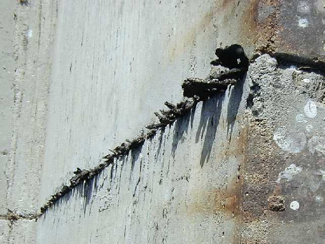
1-37
The fencing that surrounds the river bed leaks rust
along the walls of the channel, which can be seen all along
the left wall, below the CBS parking lot.
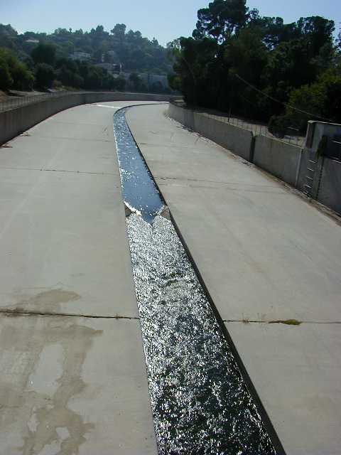
 4-03
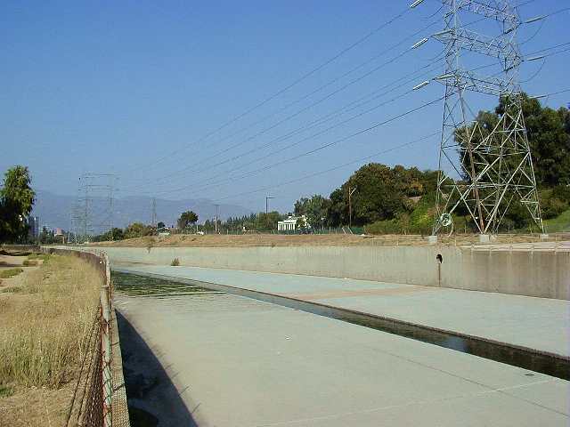
4-03
Bend in the LAR, looking at the Tujunga overpass, Studio City.
This shot seemed worthy of a full resolution picture.
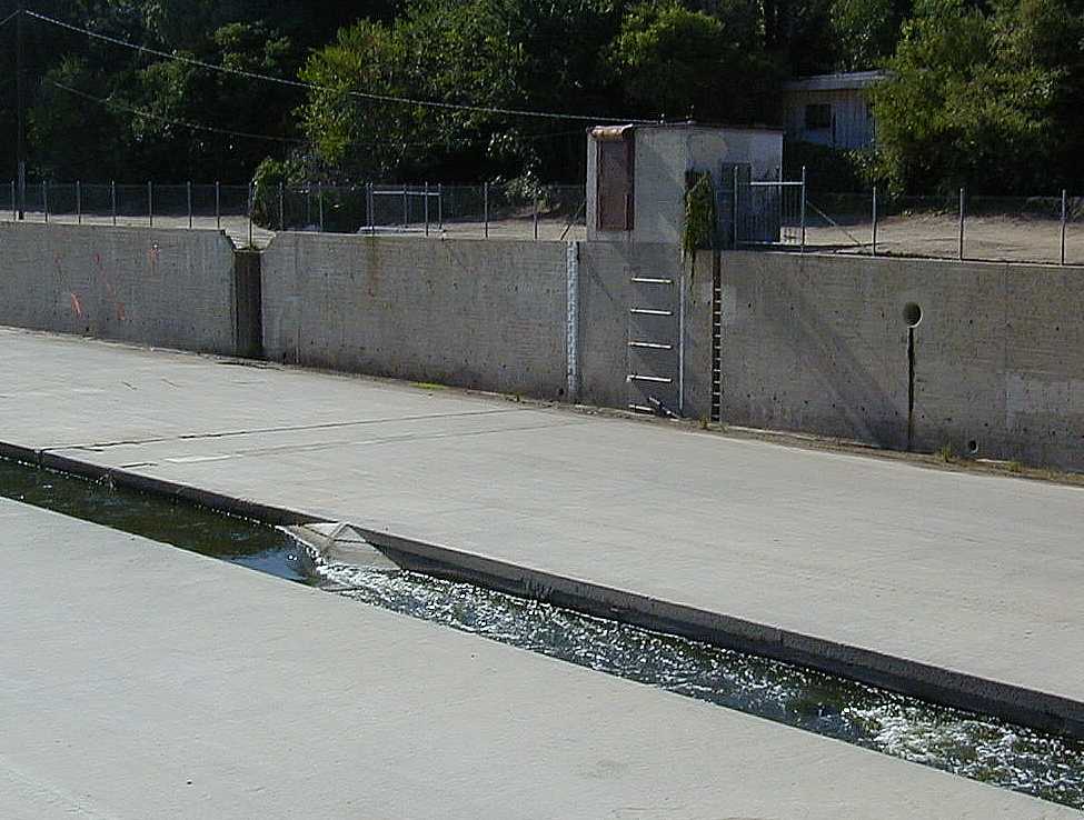
 4-05
4-05
Depth gauge and telemetry shack, west of the Tujunga overpass.
This is the telemetry shack that doubtless houses the
electronics necessary to transmit the data from the 'ladder like'
sensors along the wall.
 4-05-cu
Closeup of "LART" depth gauge and sensors, Tujunga overpass.
On the left is a visual depth gauge. A resident of the area told me
that during floods, he's seen the water level at the 17 foot mark.
Since the flow through the river is controlled at the Sepulveda basin,
it is likely they try to maintain the highest water height possible,
using the downstream telemetry gauges like this one.
 4-10-cu
Telemetry shack, and venturi constriction in slot, Tujunga overpass.
Likely, the constriction in the slot aids in gathering telemetry data
for the water going through the slot.
 4-11
4-11
Venturi turbulence, Tujunga Overpass, Studio City.
A nice shot of the turbulence caused by the venturi system (center)
in the LAR's slot, just below the telemetry shack (above right).
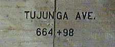 4-tujunga-ave
Tujunga Pass surveyor mark, northern wall LAR.
This mark indicates the Tujunga pass is almost 66,500 feet upstream
from the 0+00 mark which is somewhere near Griffith Park, possibly
at the Burbank flood control channel?
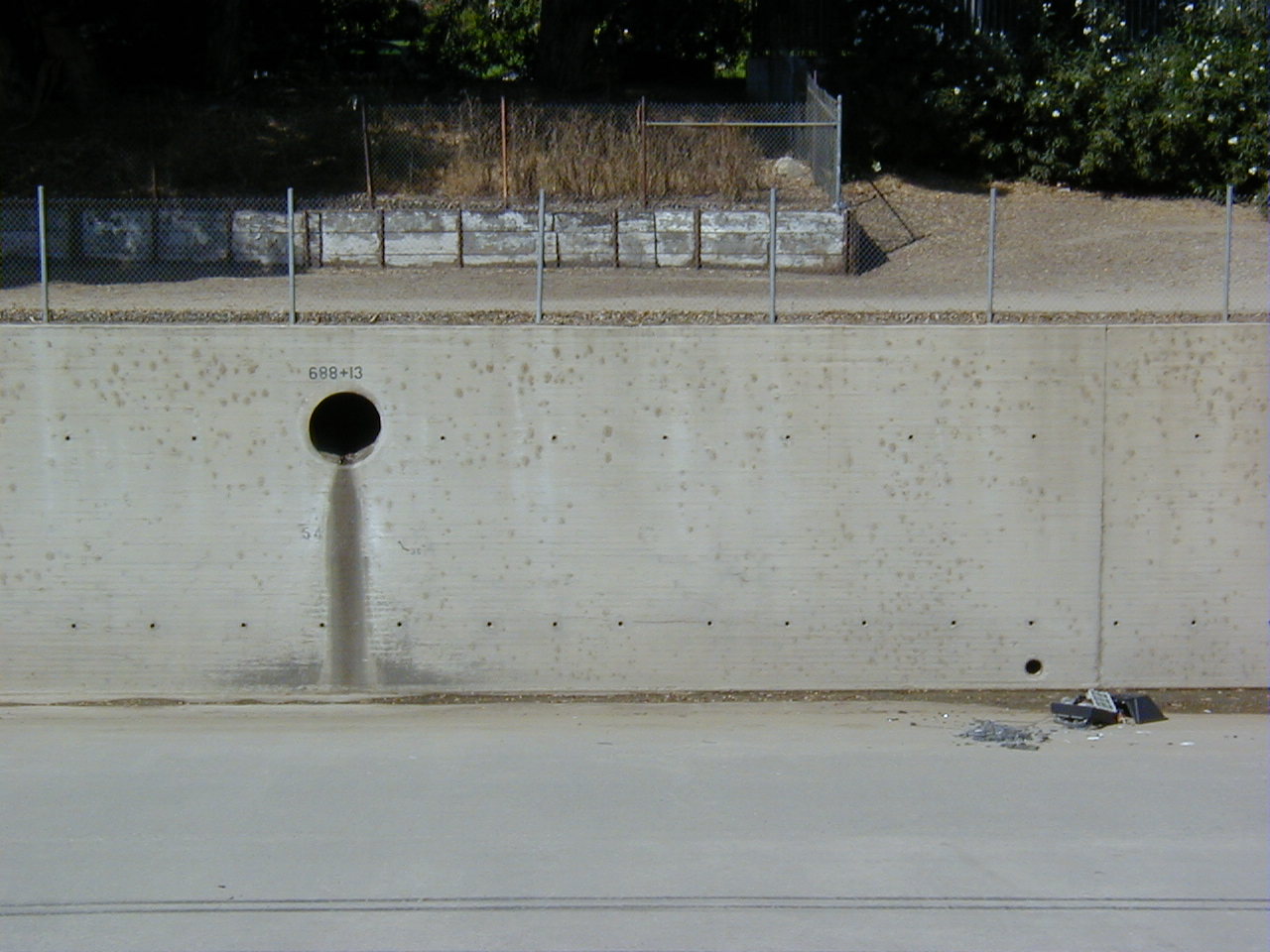
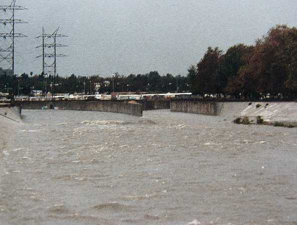
 4-1
4-1
Storm Drain merges LAR at Lankershim, circa 1991(?)
Taken during a flood, this picture shows how the
concrete constrained waters run. I love how the water
assumes the shape of the square slot in the wall.
 xx
xx
Looking upstream, at the Burbank Studios.
The slot is still intact. Forest Lawn Drive is off to the left,
separated from the LAR by a line of trees.
 xx
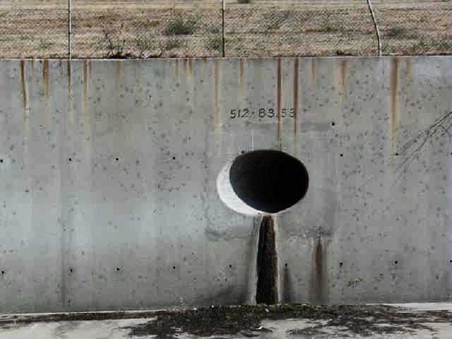
xx
Storm Drain, Southern Wall, North of Bob Hope Drive, Burbank
This is one of the few places I've seen a 3 value
station number; "512+83.58". It occurs to me (years later) that the "58"
might indicate the diameter of the pipe, or perhaps its height from the river bed.
 xx
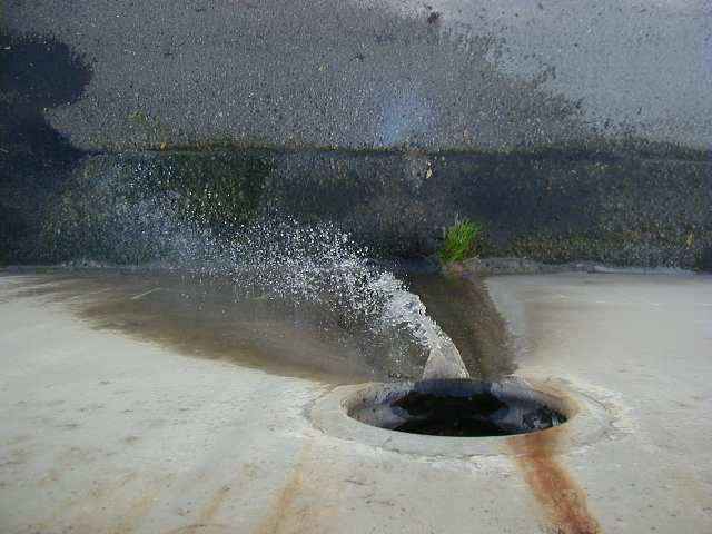
xx
Active Storm Drain, looking down the Northern Wall, Burbank
There's a strong wind here, blasting the laminar flow
into a spray, which can be felt even up on the trail.
 xx
xx
LAR passes the Forest Lawn Cemetery in distance, Burbank.
This is such a nice shot, I decided to include a
full screen
version.
 xx
xx
Looking down at sealant on Northern LAR wall, Burbank.
Years of expansion and contraction caused by the sun
against these south-facing walls of the LAR show evidence
of the grout between walls being squeezed by the expansion
of the concrete walls on hot days, causing the grout to
melt and squirt out into these weird fan-like fungus shapes.
 xx
xx
Looking Downstream towards Griffith Park, Burbank
Here is where the water in the slot begins to overflow;
you can see the algae off in the distance.
 xx
xx
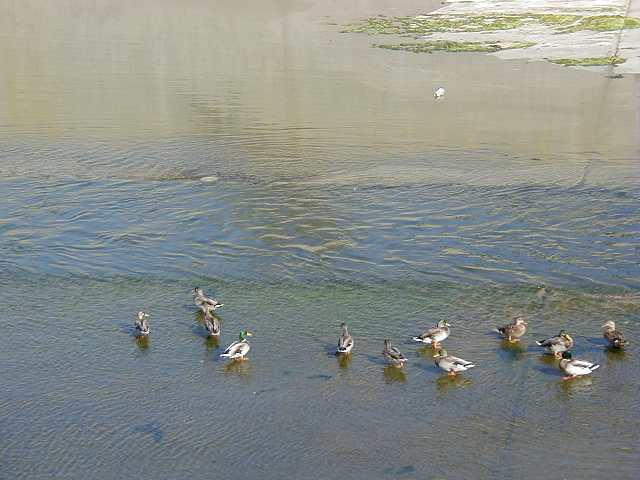
Slot goes underwater, Burbank
Actually, the water begins to overflow the slot here.
The
ducks seem
to like this, since the water slows down as it spreads
across the bed. Not far downstream the slot fans out,
and terminates.
 xx
xx
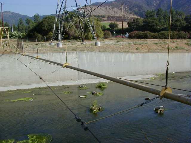
High Pressure Gas Line suspension bridge, near Bob Hope Drive, Burbank.
An effort was made to make this span flexible; note how
the pipe is thin, suspended and retained by these three
flexible steel cables. The pipe pops up from the ground
behind a steel fence, crosses the river, then goes below
ground again. The fence has pressurized gas warning signs,
and a 1-800 number to dial if the line breaks.
 xx
xx
Gas Line cable joint, northern anchorage
Because I'm such a gearhead, here's a
full screen
of this shot.
 xx
xx
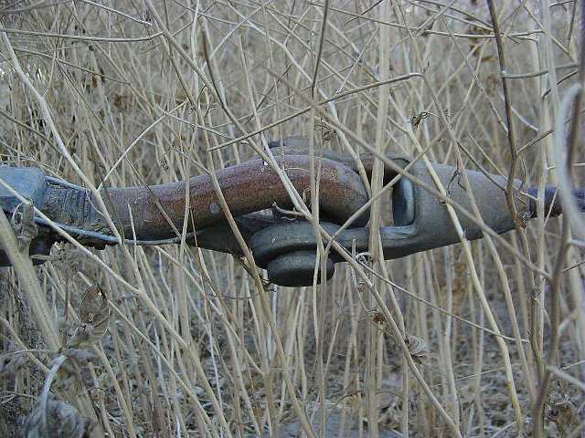
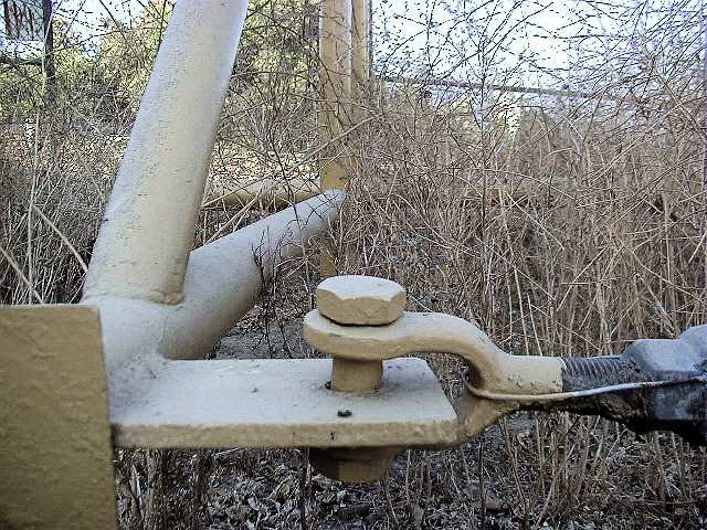
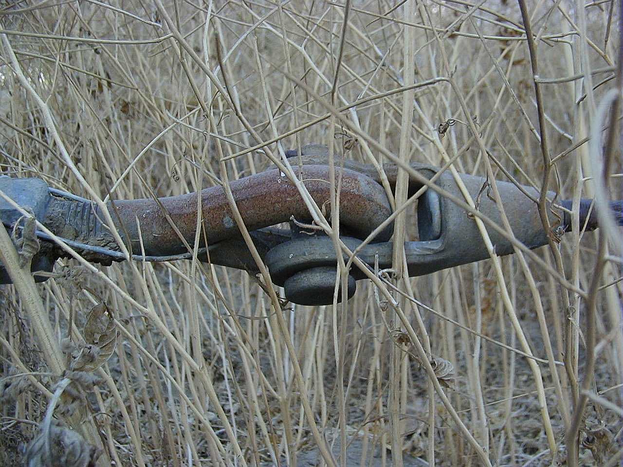
Gas Line cable-to-ground anchor
This bolt retains one of the three steel cables
that spans the entire river. To the right is a turnbuckle,
followed by the above joint to the actual cable.
 xx
xx
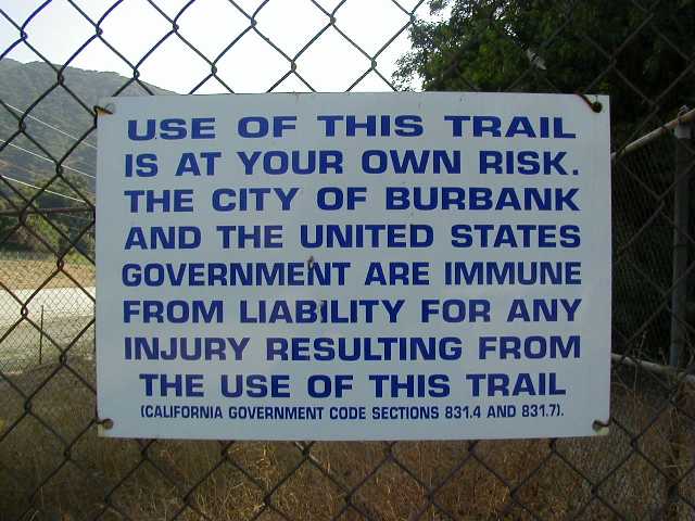
Warning Sign along northern trail, Burbank
As a scout, I'd have to say one of the most dangerous
things about these trails is people who walk their
fucking distempered dogs without leashes, who regularly
charge everyone they see. "No, Petey, come here.
Don't bite the strangers. Bad dog." Jesus.
 xx
xx
LAR looking upstream, Griffith Park
No slot; the river has spread out. That's the Ventura Freeway
in the distance, behind the line of trees. The freeway
crosses over the river in the distance. To the right
is an equestrian center of some kind; lots of horse trails.
 xx
xx
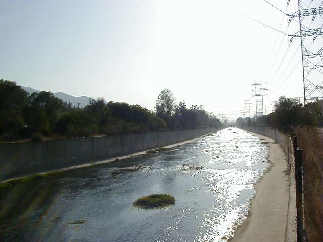
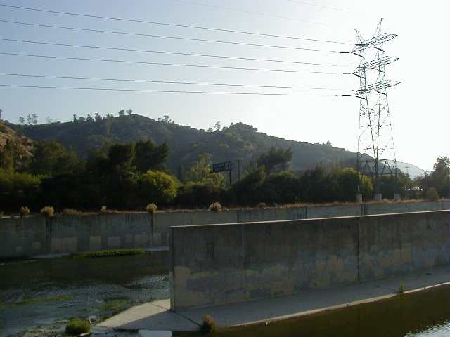
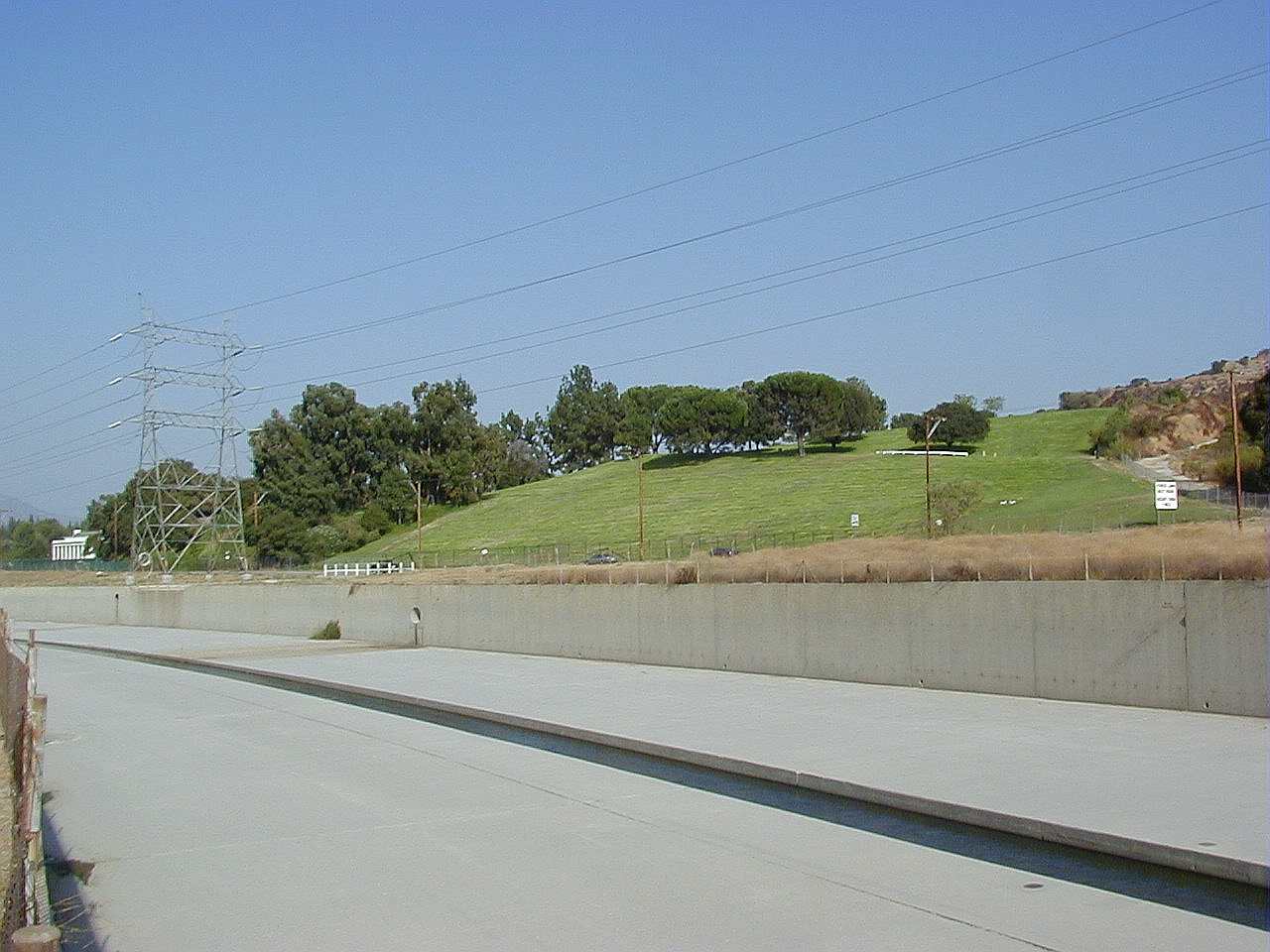
Looking Upstream; LAR (left) meets Burbank Flood Control Channel (right)
This shot is looking upstream, taken from atop the "training wall"
between the two rivers, a thin concrete 'peninsula' that extends
down river for about 50 feet or so before terminating abruptly.
The LA River is at the left, and the Burbank Flood Control Channel
tributary at the right. Most of the dry season flow on the right
(and there's quite a bit) is from the United Water treatment plant near the
Burbank Blvd overpass for the 5 Fwy.
 xx
xx
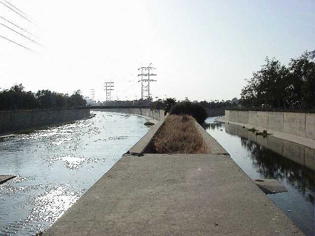
Looking Downstream; LAR (right) meets Burbank Flood Control Channel(left)
This is taken from atop the extension wall 'peninsula'
facing downstream, looking at the spot I was standing
to take the above photograph. Off in the distance is
the Victory overpass.
 xx
xx
Extension Wall, LAR/BFCC
The extension wall where the two rivers meet
(the wall I was standing on to take the above two shots).
I believe this is where the station numbers go to zero (0+00).
I guess the river was built as several separate 'projects',
and this is where one project ends, and another starts.
 xx
xx
LAR/BFCC confluence, taken from LAR riverbed
Here's where the walls become diagonal, and you can
actually walk down into the river bed. There is a
ramp off to the right from the horse trail.
 4-3
4-3
LAR/BFCC during flood, circa 1991.
Looking upstream from the Victory overpass.
Note walls transition from vertical to a 45 degree angle here,
which is the state they remain for the next 30 miles,
all the way to the ocean.
This was taken after the rains subsided; the river was
much closer to the top hours earlier!
Here's an
overhead view of that section of the river.
Next Page...

Back to my home page.
All images on this page © Copyright 2000 Greg Ercolano. All rights reserved.